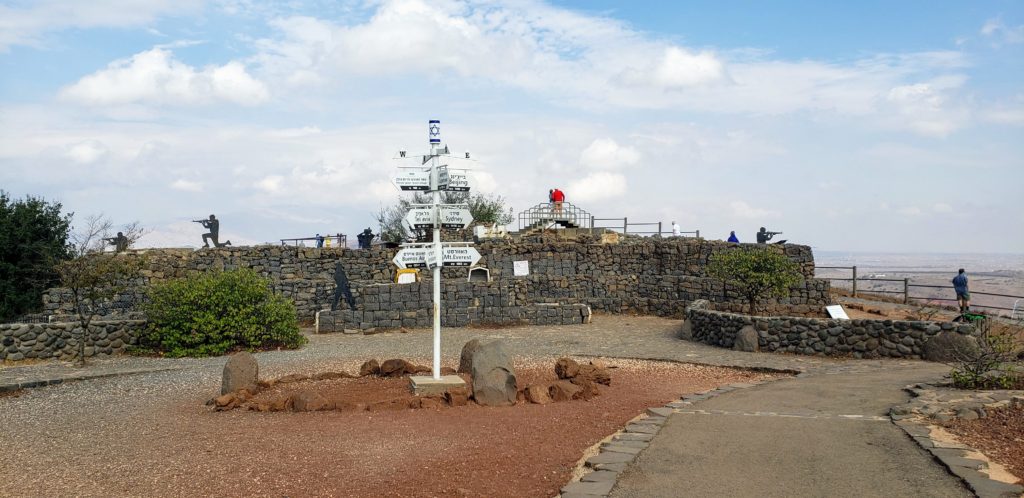
Internationally recognised as Syrian territory, the Golan Heights has been occupied by Israel since the 1967 war. Antony was keen to see the area so we hired a car for a day from Tiberias and set off to the north east of the Sea of Galilee. First stop Mount Bental for amazing panoramic views of the area.
After Israel captured Golan Heights from Syria in 1967, it was under Israeli military administration but then in 1981 Israel passed a law to administer it as part of Israel. This effective annexation of Syrian land was condemned by the UN Security Council, which stated that “the Israeli decision to impose its laws, jurisdiction, and administration in the occupied Syrian Golan Heights is null and void and without international legal effect” (Resolution 497). The United States is the only country in the world to recognise Israeli sovereignty over the annexed regions of the Golan Heights – after Donald Trump proclaimed it this year in March. So while technically Syrian, it seemed like it was just another part of Israel.
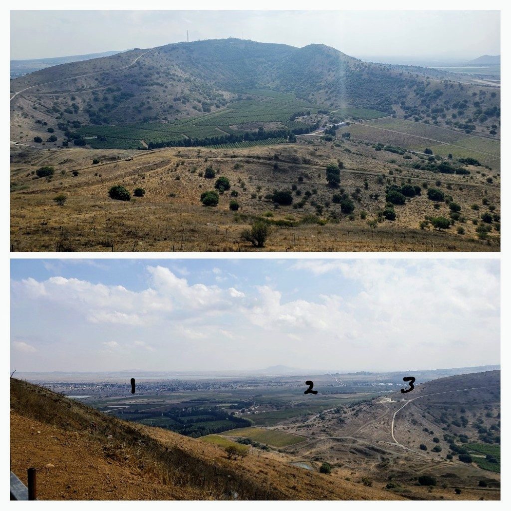
Mt Bental is a strategic spot in the heart of the Golan with fantastic panoramic views. It was strange to look out over Syria and to think of all the trouble that is there at the moment and to imagine battles fought in this very place in 1967 and again in 1973 when Syria launched a surprise attack on Yom Kippur. Israel managed to survive the October 1973 attack, push back to the 1967 ceasefire ‘purple line’ and even beyond it, despite being massively outnumbered, about 100 tanks to the Syrian’s 800.
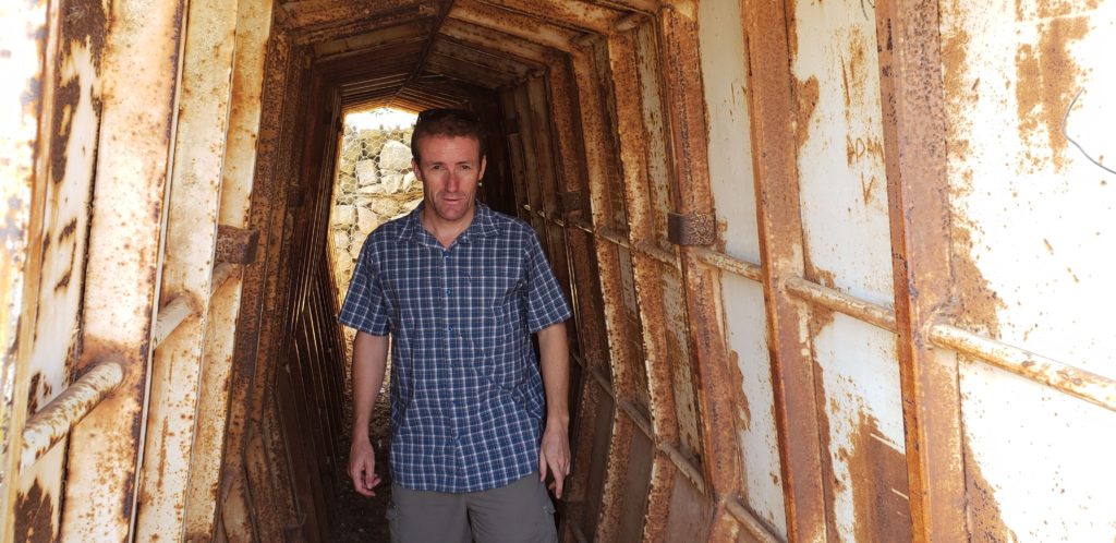
At the top of Mt Bental the bunkers and trenches are open for visitors to wander in and around. We saw a couple of UN guys getting briefed on the lay of the land from up there.
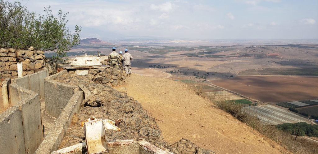
The United Nations Disengagement Observor Force (UNDOF) was established in 1974 to ensure the ceasefire was maintained, supervise the buffer zone between Syria and the Israeli occupied Golan Heights and keep an eye on military presence on both sides of the 80km long buffer. Because there has been no permanent resolution to the Israeli occupation of the Golan Heights and the area is not exactly stable, the UNDOF are still required in the area 45 years on. They have a base down by the border (#3 in picture above), near the ruined town of Quinetra.
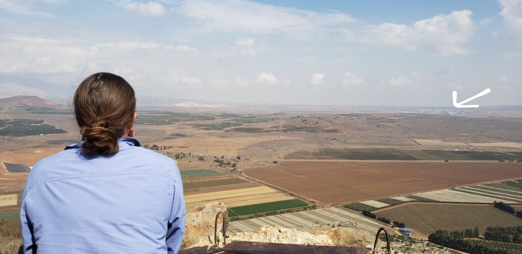
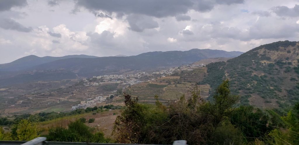
We left Mount Bental and headed further north to the Druze town of Mas’ade for lunch. Mas’ade is one of the four remaining Druze-Syrian communities on the Israeli-occupied side of the Golan Heights and on Mount Hermon. The largest of the four is Majdal Shams, considered the ‘capital’ of the Golan Heights but we didn’t go that far north. Majdal Shams provides the setting for the Israeli movie ‘The Syrian Bride‘. The film is about someone from here wanting to marry a Syrian across the border, and how they try to cross the buffer zone. Usually only UN personnel are able to cross but there are actually laws allowing this crossing for Syrian Brides. The catch though- it is only one way. The women can’t return to their homes or families in Israeli occupied Golan, once they enter Syria.
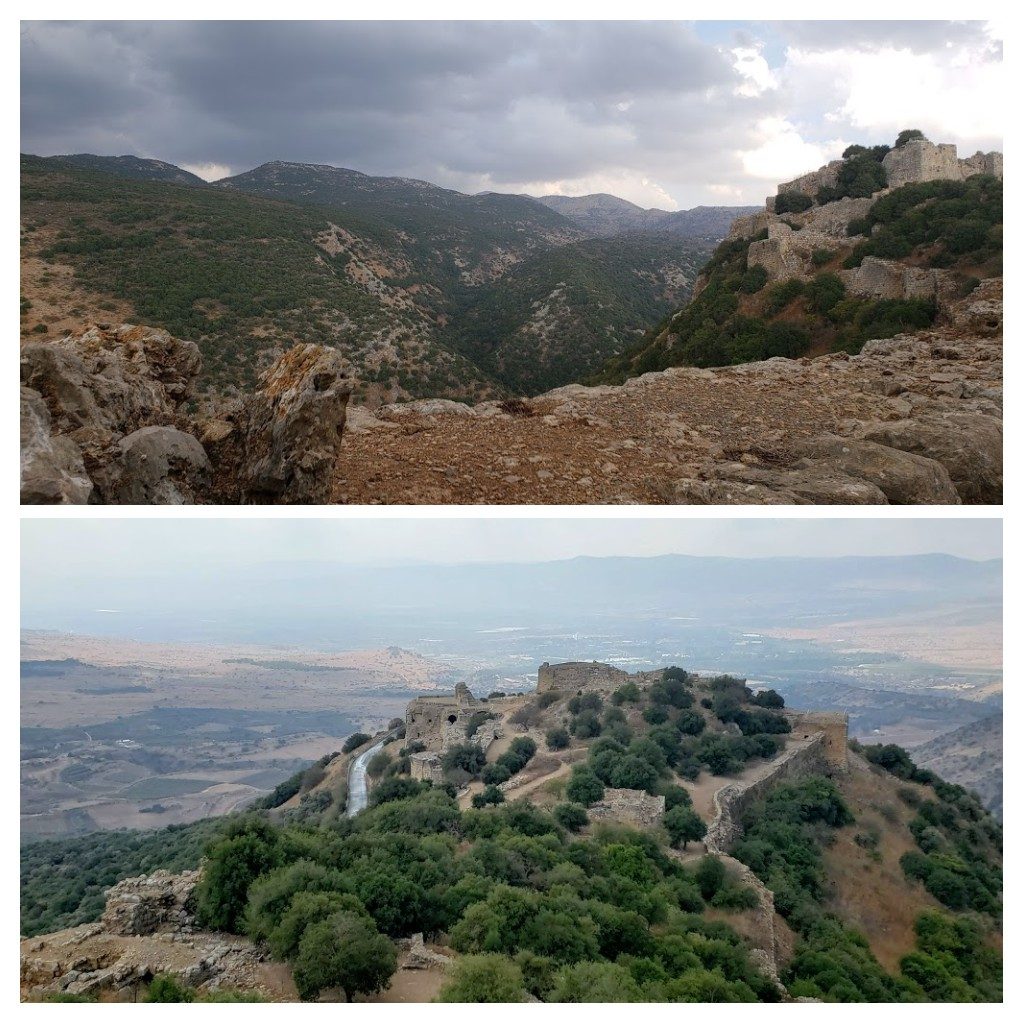
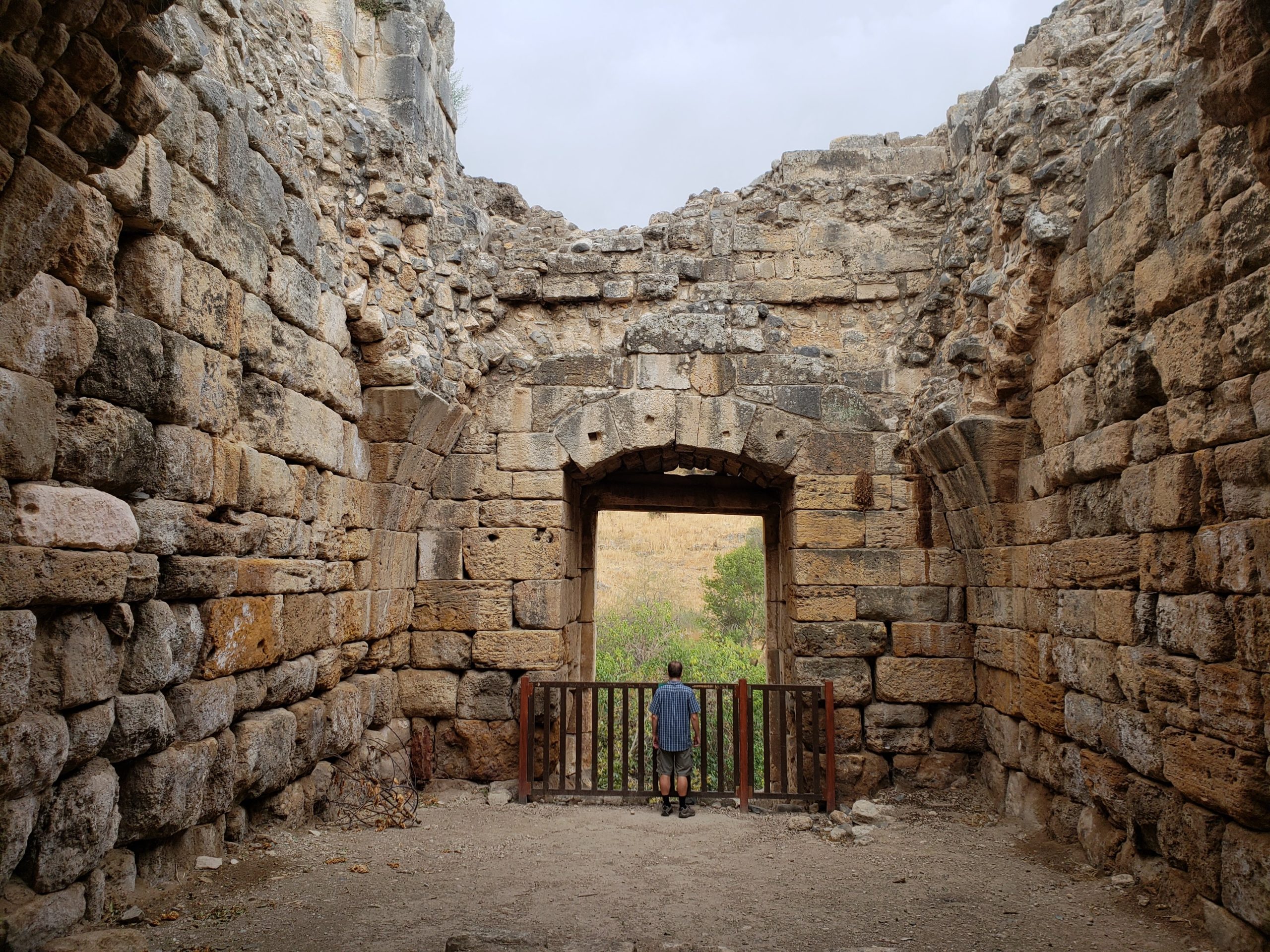
Our next stop was Nimrod Fortress National Park, on the slopes of Mount Hermon. The impressive medieval fortress is atop a ridge, 815m above sea level. It was built in 1227 by the Muslim governor of Banias, to prevent the Crusaders attacking Damascus. It controlled one of the region’s main roads, from Tyre on the Mediterranean coast through the upper Hula Valley and Banias to Damascus.
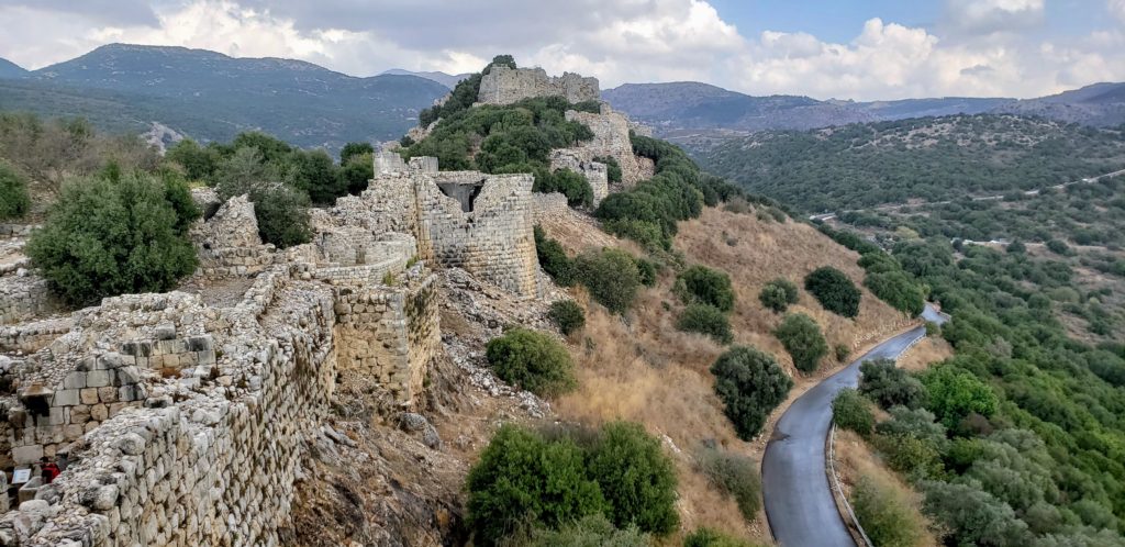
In 1230 the fortress was reinforced and expanded. It was briefly captured and held by the Mongols in 1260. When they were defeated by the Mamluks later that year, Sultan Baybars strengthened the fortress with large towers.
The importance of the fortress declined after the Crusaders were ejected from the Holy Land at the end of the 13th century. Since then it served as an Ottoman prison then as shelter for shepherds and their flocks.
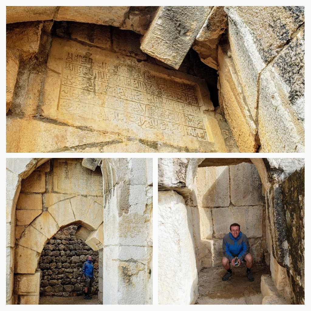
We pretty much had this place to ourselves which was awesome. We enjoyed exploring from one end to the other and back again. We started with the Northwest tower (pictured above), passing by the toilet room and then through the archway with an Arabic inscription above it from the first stage of fortress construction (1228). Apparently the stones in this arch shifted in a 1759 earthquake but the arch did not collapse.
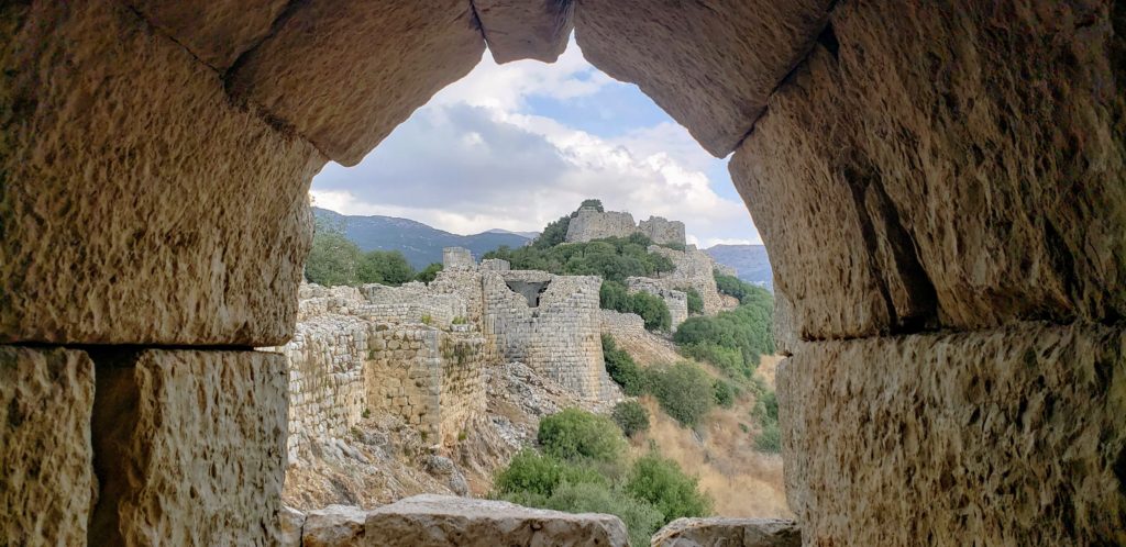
Great views were to be had from the Southwest tower, views of the Galilee, the Hula Valley, the slopes of the Golan and the fortress to the East. We could also go to an interior hall of the original tower – which is where I took the photo above. That was pretty special – to be inside – usually the ceilings are no longer in fortresses like this so it’s just open air.
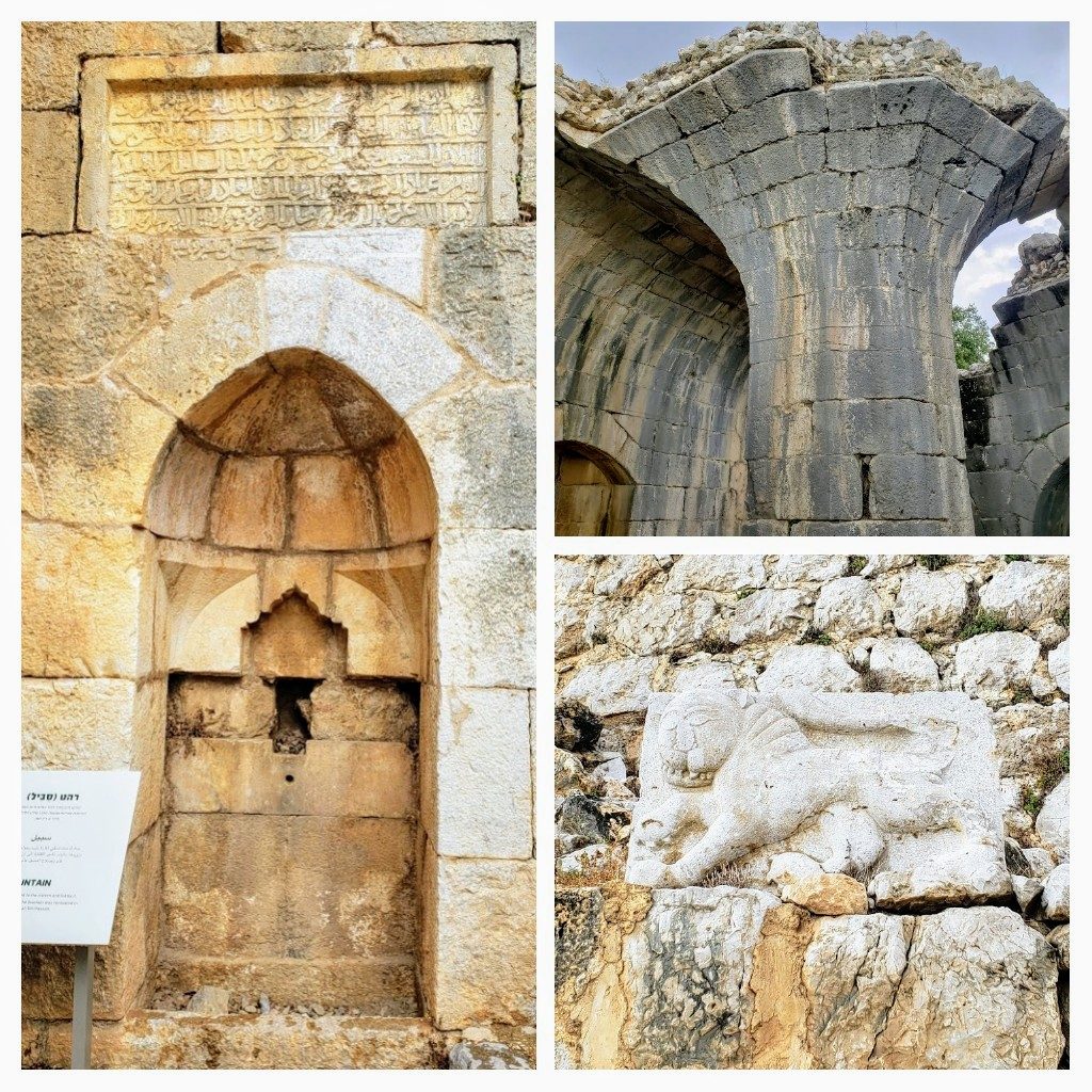
Aside from the great views of and from the fortress there were a few things of note along the way. Not far from the south west tower is a public drinking fountain with an inscription from 1240. Walking on, beside the southern wall, we get to the ‘Beautiful Tower’ which is a semicircular tower built by Baybars. The inside of it is octagonal and it has a vaulted roof – apparently this is outstanding construction quality – perhaps why they named it as they have. It was pretty cool! Not far from the massive inscription in his honour, we spotted a sculpted lion, symbol of Mamluk Sultan Baybars who conquered the fortress from the Mongols in 1260.
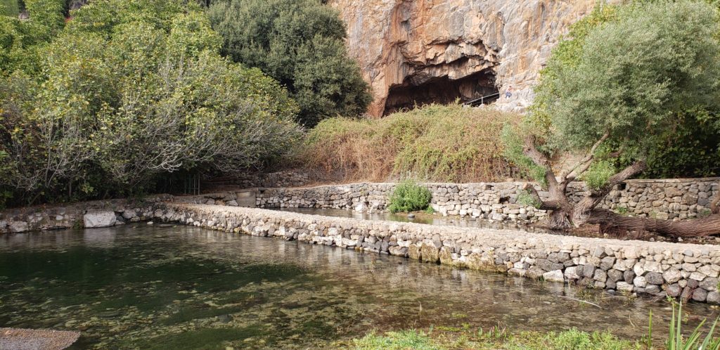
Having explored all over Nimrod Fortress and enjoyed the stunning views from every side, it was time to head back down the road and along not too far to our next stop. The Hermon Stream Nature Reserve – also known as Banias – is home to the Hermon Springs which emerge at the foot of Mount Hermon. These springs create the Dan, Hermon (Banias) and Senir streams which are the headwaters of the Jordan river. The Hermon Stream receives its water from the southern slopes of Mt Hermon and the northern Golan and emerges at the base of the Banias Cave.
We didn’t have enough time to explore the whole Nature Reserve so left off the Banias Waterfall (Israel’s largest waterfall) and headed for the Springs entrance. We had about 2 hours and followed a couple of the trails to see almost everything at this end of the reserve.
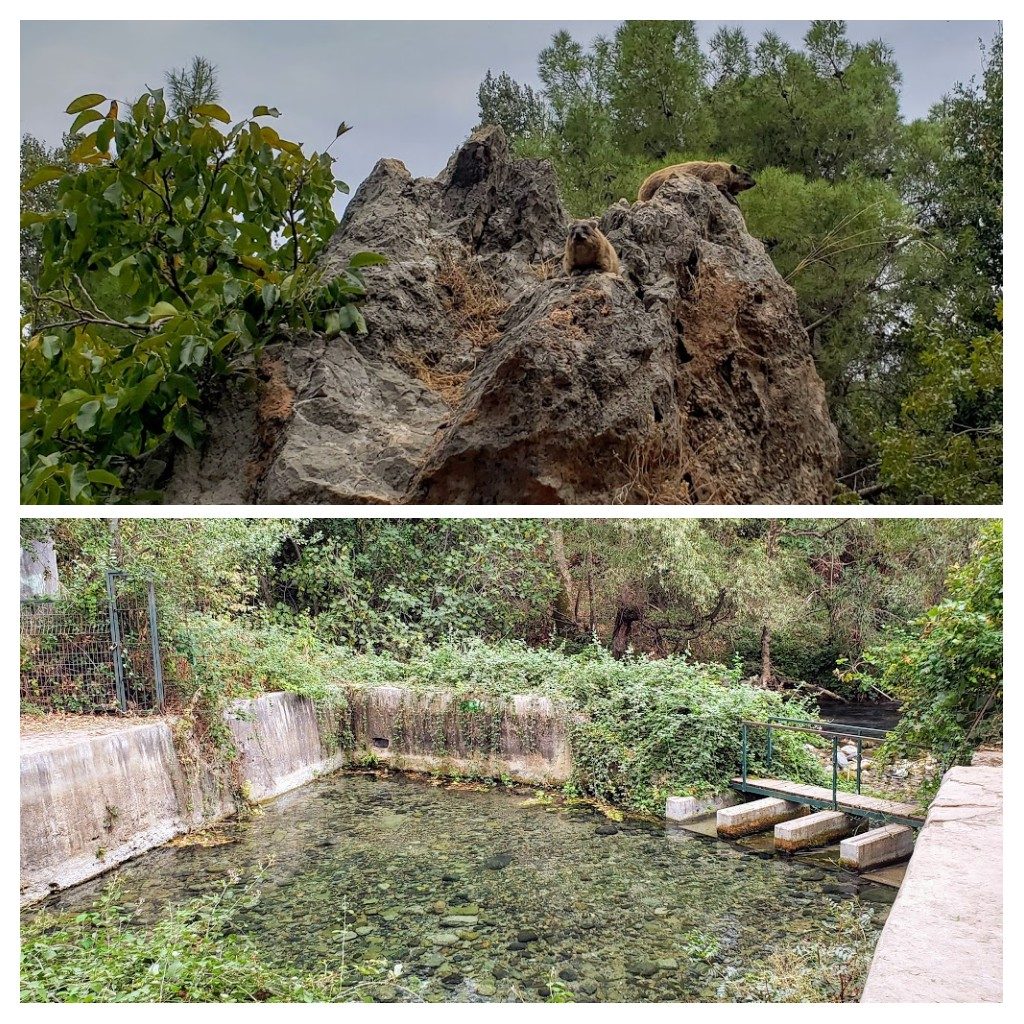
The reserve is home to a few animals but most of them are nocturnal. We saw the most common animal there though – the Syrian Rock Hyrax sunning themselves on large boulders. They were pretty cute.
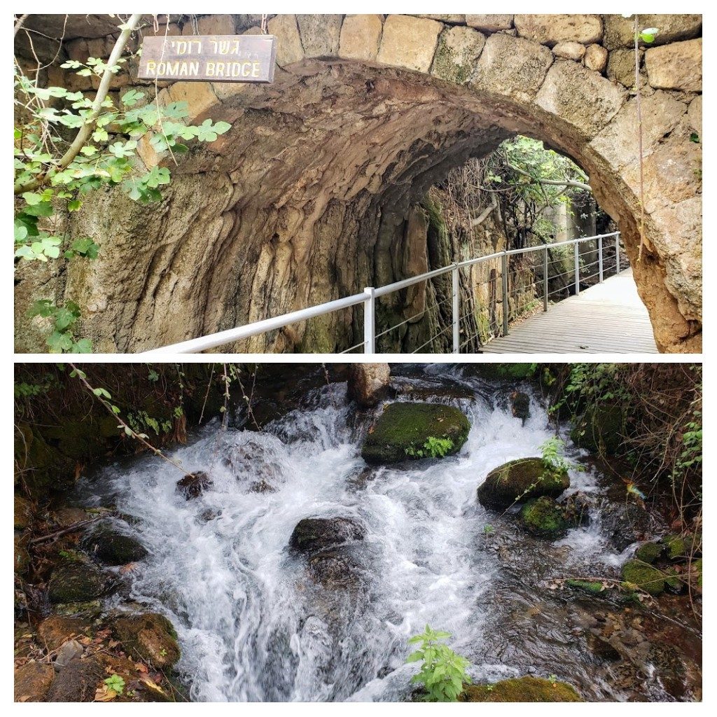
Our walk took us under an old Roman bridge, alongside the flowing waters of the Hermon Stream and also to the Officer’s Pool – where the Ein Hilu Springs emerge. The Syrians built a concrete pool over the spring which served their soldiers until the Six-Day War in 1967. We could see the bubbles rising from the bottom of the pool revealing where the spring emerges.
The springs, stream and trees around it were lovely, but we are rather spoilt coming from New Zealand with so many incredible forests, rivers, waterfalls and national parks available for free – that this pales in comparison. What we came for though was the history… and that New Zealand can’t compete with! The nature reserve has a number of significant ruins that were part of the ancient city of Paneas also known as Caeserea Philippi. We’re talking about 300 years BCE when Greek culture was taking over in this part of the world, following the conquest of Alexander the Great in 332 BCE.
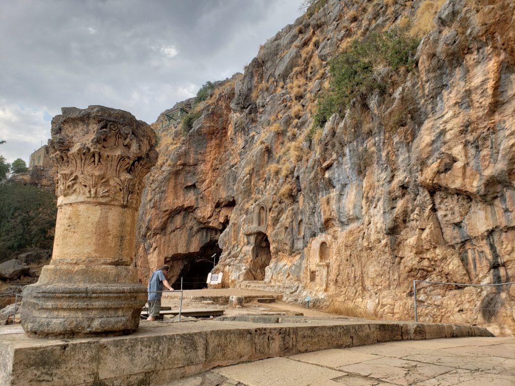
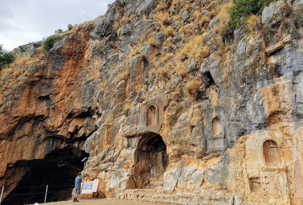
The Greeks were impressed by the majestic setting of the area around the springs so established a city here. Banias Cave was particularly admired as it had a deep natural chasm in the floor, which led to ground water. From about the 3rd century BCE ritual sacrifies had become common-place at the cave (where animals sacrifices were thrown into the chasm) and so the cave was sanctified and dedicated to Pan, the god of the wild and the forest. It was here the Temple of Pan was built. The city Panium or Paneas – or Banias according to Arabic pronunciation, took its name from the god Pan.
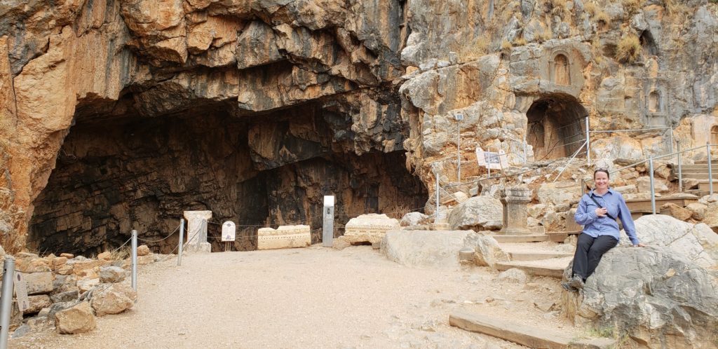
Several power struggles and shifts in governance occured over the first couple of centuries of the city’s existence before the Romans annexed the city to the kingdom of Herod the Great at the end of the first century BCE. Herod then had a temple built here in honour of Emperor Augustus. When Herod died, his son Philip inherited the Golan Heights and northern part of his kingdom, making Paneas the capital in 2 BCE. He named it Caesarea Philipi although the popular name Paneas persisted.
Jesus visited the city around 29 CE and Matthew (ch. 16) records a conversation on the road here between Jesus and his disciples where Jesus asks them; ‘who do people say I am?’ and Simon Peter replies that Jesus is the Messiah. After this Jesus annouces that upon Peter, the rock he will build his church. The fact that this was the first proclamation of Jesus as Messiah, may be why we encountered a large group (at least a bus load, perhaps two) of American Christians who had taken over the area by the springs with a drone, video cameras and a guy with a megaphone loudly proclaiming Jesus ‘name above all names’ and other exaltations!
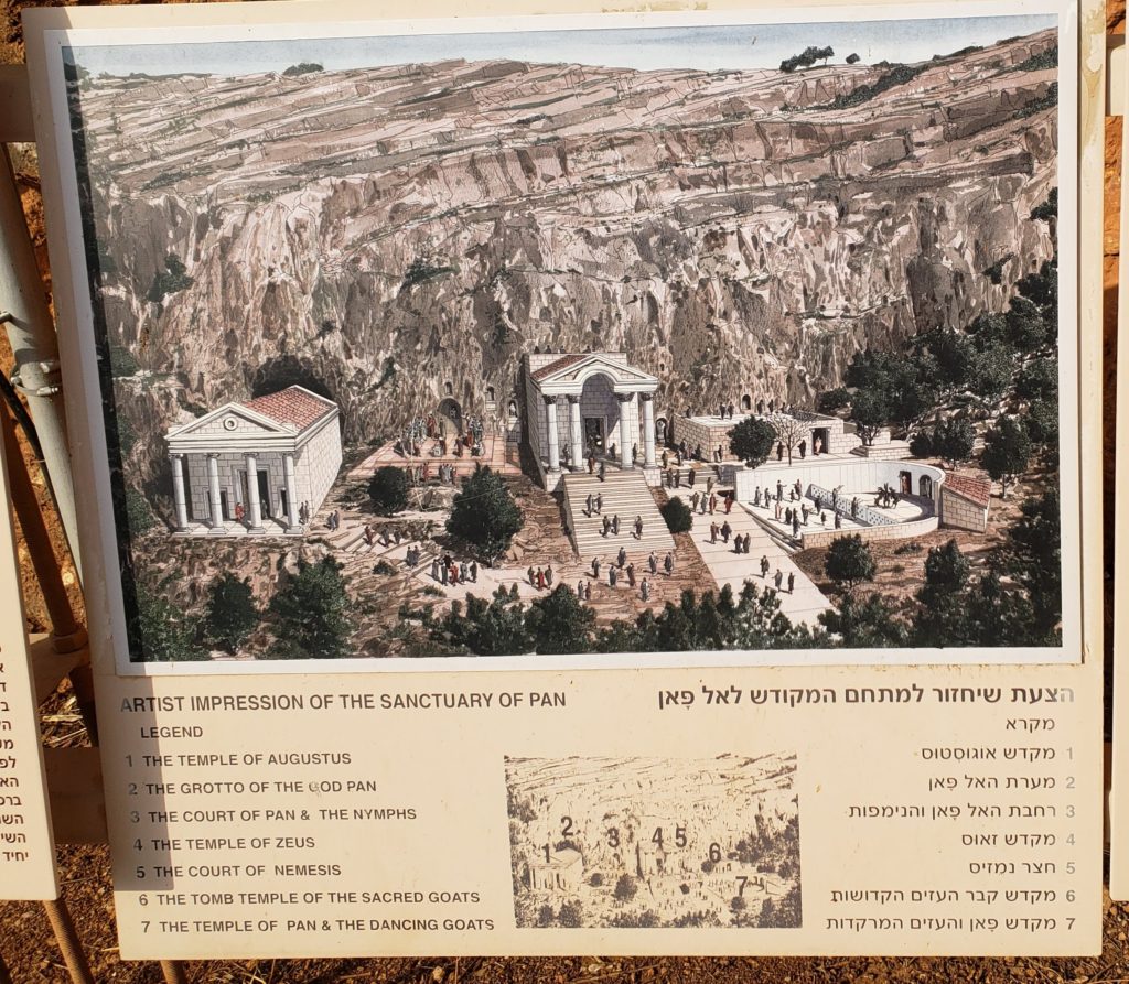
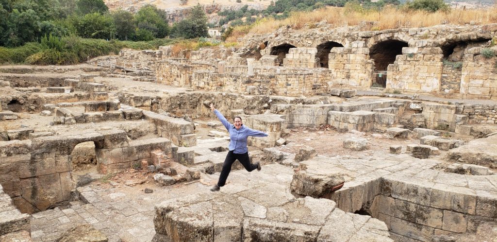
Paneas was incorporated into the kingdom of Syria and given autonomy after Philip died in 34 CE. But that didn’t last long as the city was given to Philip’s nephew Herod Agrippa I in 37 CE and then his son Agrippa II in 53 CE. Agrippa II expanded and enhanced the city with beautiful statues and magnificent buildings (according to the historian of the time, Josephus Flavian). We saw the ruins of one of his grand buildings that served as a palace and a seat of government, with the row of vaults used as warehouses.
Pagan practices in Paneas continued until Christianity gained a stronger influence between the 4th – 6th centuries CE. Pagan worship of Pan then came to an end and temples were abandoned but the city continued to prosper until after the Muslim conquest in the seventh century.
The Crusaders considered Banias a strategic asset because of its position on the crossroads between Sidon and Tyre in Lebanon, and Damascus. They captured it from the Muslims but then the Mamluks took it back, after 1187, fortifying it but then abandoning it as it declined in importance. The great city became a small village, until it was captured by Israel in 1967.
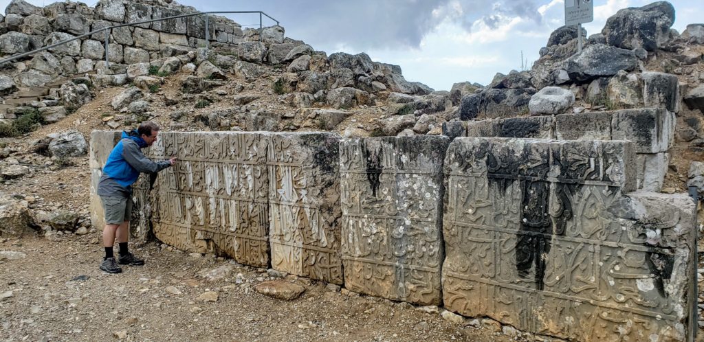
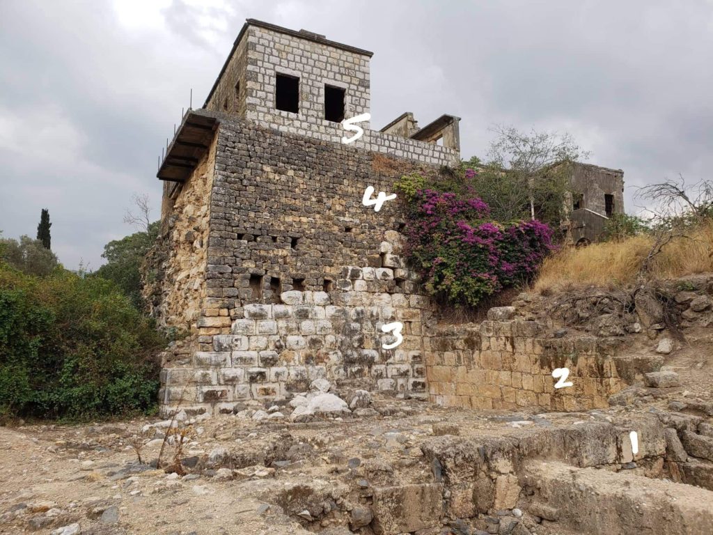
Just near the exit back to the Springs carpark, at the northern corner of the city wall there is a corner tower and evidence of various periods in the area’s history. The lower walls (1) date to Roman and Byzantine times (3rd-6th centuries CE). Above them we can see remains of the 12th century Crusader wall (2). Next we have remnants of the Ayubbid tower built in the 13th century (3) and Ottomoan additions (4) to the tower (19th century). The top of the tower has a modern Syrian structure (5).
We enjoyed this lovely Nature Reserve, the pretty springs and flowing stream and the evidence of a thriving ancient city once here. As the sun started to set we headed out of the Golan Heights to our next destination – the coastal city of Acre.